 VLIZ Geonetwork
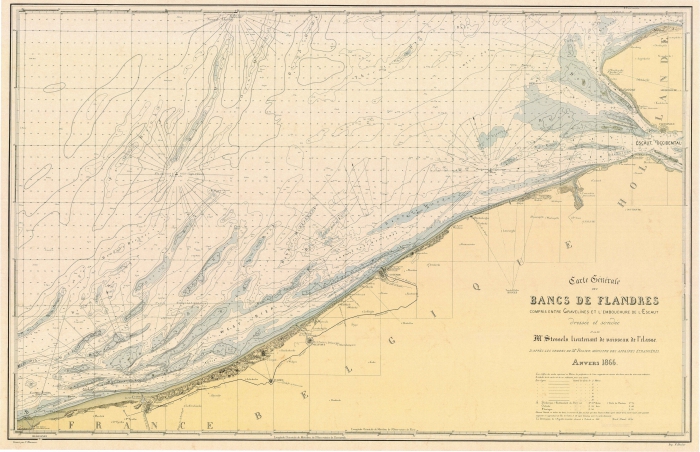
Carte Générale des Bancs de Flandres compris entre Gravelines et l'embouchure de l'Escaut
Simple
- Date (Revision)
- 2017-01-18
- Citation identifier
- Stessels_1866
- Cited responsible party
-
Organisation name Individual name Electronic mail address Role Vlaams Instituut voor de Zee (VLIZ)
Owner
- Presentation form
- Digital map
- Point of contact
-
Organisation name Individual name Electronic mail address Role Vlaams Instituut voor de Zee
Point of contact
- Keywords
-
-
{hgauth}Stessels, A.
-
{hgloc}Belgian Coast
-
{hgloc}Belgian East Coast
-
{hgloc}Belgian West Coast
-
{hgloc}Sandbanks
-
{hgloc}North Sea
-
{hgloc}
-
{hgtheme}Bathymetric information
-
{hgtheme}Nautical map
-
{hgtheme}Flemish Banks
-
{hgcent}19° century
-
{hglang}French
-
{hgid}Stessels_1866
-
{picid}15526
-
{hgdistid}
-
{hgowner}<a href=" http://www.vliz.be/" target="_blank">Flanders Marine Institute</a>
-
Citation: HisGISKust; Flanders Marine Institute (2016) Carte Générale des Bancs de Flandres compris entre Gravelines et l'embouchure de l'Escaut ( http://geonetwork.vliz.be/geonetwork/srv/eng/catalog.search#/metadata/3fec7170-06aa-40cd-b8e2-87a326fd2d2f)
-
- Keywords
-
- Use limitation
-
no limitations
- Access constraints
- Other restrictions
- Use constraints
- Other restrictions
- Classification
- Unclassified
- Spatial representation type
- Vector
- Denominator
- -
- Language
- Nederlands; Vlaams
- Character set
- UTF8
- Topic category
-
- Geoscientific Information
))
- Reference system identifier
- http://www.opengis.net/def/crs/EPSG/0/3857
- Distribution format
-
Name Version tiff
1
- Distributor contact
-
Organisation name Individual name Electronic mail address Role Flanders Marine Institute (VLIZ)
Distributor
Digital transfer options
- OnLine resource
-
Protocol Linkage Name http://www.vliz.be/hisgiskust OGC:WMS-1.1.1-http-get-map
http://geo.vliz.be:80/geoserver/HistorischeKaarten/ows?SERVICE=WMS& Stessels_1866
- Hierarchy level
- Dataset
Conformance result
- Title
-
COMMISSION REGULATION (EU) No 1089/2010 of 23 November 2010 implementing Directive 2007/2/EC of the European Parliament and of the Council as regards interoperability of spatial data sets and services
- Alternate title
-
INSPIRE Data Specification
- Date (Publication)
- 2010-12-08
- Explanation
-
INSPIRE Data Specification
- Pass
- No
- Statement
-
1) Scanning
2) Georeference:
Transformation type: Thin Plate Spline
Sampling method: Nearest neighbour
Background layer:
Coordinate system: WGS 84 (EPSG:4326)
Ground control points: 52
Mapanalyst:
Scale: -
Rotation: -
Standard deviation: -
Mean Position Error: -
Transformation: -
Metadata
- File identifier
- 3fec7170-06aa-40cd-b8e2-87a326fd2d2f XML
- Metadata language
- Nederlands; Vlaams
- Character set
- UTF8
- Hierarchy level
- Dataset
- Date stamp
- ####
- Metadata standard name
-
ISO19115
- Metadata standard version
-
2003/Cor.1:2006
- Metadata author
-
Organisation name Individual name Electronic mail address Role Flanders Marine Institute (VLIZ)
Point of contact
- Other language
-
Language Character encoding English UTF8 Dutch; Flemish UTF8

)))