 VLIZ Geonetwork
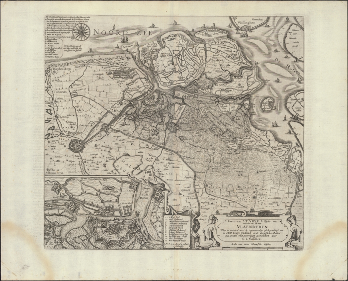
Caerte van t'Vrye sijnde een gedeelte en lidt van Vlaenderen waer in vertoont wert de tegenwoordige ghelegentheijt van de
stadt Sluys Cadsand en de doorgesteken polders met grooten vlijt gecorrigeert en verbetert
In the framework of the initiative HisGISKust, a collaboration agreement was established between Flanders Marine Institute (VLIZ) and Cultuurbibliotheek (Bruges). Historic maps from the collection of Cultuurbibliotheek with specific information about the coastal zone, Scheldt Estuary and/or the Belgian part of the North Sea were selected. These maps were digitized and georeferenced by VLIZ and are disclosed in open access to end users together with the appropriate metadata. Based on the georeferenced maps, shapefiles were generated as well (e.g. coastline, dune area, etc.).
Simple
-
Date (Revision)
- 2016-03-01
-
Citation identifier
-
K3_60_2007_465
- Cited responsible party
-
Organisation name Individual name Electronic mail address Role Vlaams Instituut voor de Zee (VLIZ)
Owner
-
Presentation form
-
Digital map
- Point of contact
-
Organisation name Individual name Electronic mail address Role Cultuurbibliotheek
Point of contact
- Keywords
-
-
{hgauth}Visscher, Claes Jansz; Hondius, Henricus (graveur)
-
{hgloc}Belgian East Coast
-
{hgloc}Western Scheldt
-
{hgloc}Sandbanks
-
{hgtheme}City plan
-
{hgtheme}Topographic map
-
{hgtheme}Flemish Banks
-
{hgcent}17° century
-
{hglang}Dutch
-
{hgid}K3_60_2007_465
-
{picid}111617
-
{hgdistid}112006
-
{hgowner}<a href=" http://www.cultuurbibliotheek.be/" target="_blank">Cultuurbibliotheek</a> (processed by <a href=" http://www.vliz.be" target="_blank">VLIZ</a>)
-
{hgshapekustlijn}
-
Citation: HisGISKust; Cultuurbibliotheek (processed by VLIZ) (2016) Caerte van t'Vrye sijnde een gedeelte en lidt van Vlaenderen waer in vertoont wert de tegenwoordige ghelegentheijt van de stadt Sluys Cadsand en de doorgesteken polders met grooten vlijt
-
- Keywords
-
-
Use limitation
-
no limitations
-
Access constraints
-
Other restrictions
-
Use constraints
-
Other restrictions
-
Classification
-
Unclassified
-
Spatial representation type
-
Vector
-
Denominator
- 107400
-
Language
- Nederlands; Vlaams
-
Character set
-
UTF8
-
Topic category
-
-
Geoscientific Information
-
))
-
Reference system identifier
-
http://www.opengis.net/def/crs/EPSG/0/3857
- Distribution format
-
Name Version tiff
1
- Distributor contact
-
Organisation name Individual name Electronic mail address Role Flanders Marine Institute (VLIZ)
Distributor
Digital transfer options
- OnLine resource
-
Protocol Linkage Name http://www.vliz.be/hisgiskust OGC:WMS-1.1.1-http-get-map
http://geo.vliz.be:80/geoserver/HistorischeKaarten/ows?SERVICE=WMS& K3_60_2007_465
-
Hierarchy level
-
Dataset
Conformance result
-
Title
-
COMMISSION REGULATION (EU) No 1089/2010 of 23 November 2010 implementing Directive 2007/2/EC of the European Parliament and of the Council as regards interoperability of spatial data sets and services
-
Alternate title
-
INSPIRE Data Specification
-
Date (Publication)
- 2010-12-08
-
Explanation
-
INSPIRE Data Specification
-
Pass
- No
-
Statement
-
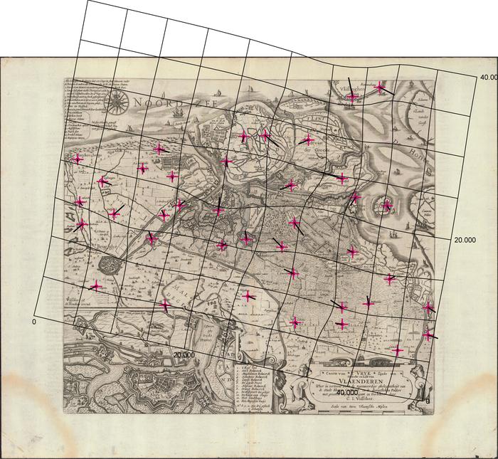
1) Scanning
2) Georeference:
Transformation type: Thin Plate Spline
Sampling method: Nearest neighbour
Background layer: OpenStreetMap
Coordinate system: WGS 84/ Pseudo Mercator (EPSG: 3857)
Ground control points: 39
Mapanalyst:
Scale: 107400
Rotation: 12deg; cw
Standard deviation: ca. 876 m
Mean Position Error: ca. 1239 m
Transformation: Helmert 4 parameters
Metadata
-
File identifier
- 879cb002-ef44-4088-bf17-96e9a68281f0 XML
-
Metadata language
- Nederlands; Vlaams
-
Character set
-
UTF8
-
Hierarchy level
-
Dataset
-
Date stamp
- ####
- Metadata standard name
-
ISO19115
- Metadata standard version
-
2003/Cor.1:2006
- Metadata author
-
Organisation name Individual name Electronic mail address Role Flanders Marine Institute (VLIZ)
Point of contact
- Other language
-
Language Character encoding EnglishUTF8
)))